About geofences with Splunk AR
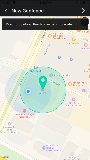
Geofences are GPS-based boundaries that allow a mobile device to trigger an action, such as receive dashboards, when the mobile device enters or exits the area.
Create geofences on a GPS map in the Splunk AR app, and associate the GPS defined region with Splunk dashboards:
Splunk AR users can view these dashboards when they enter the defined region.
What are the differences between geofences and beacons?
Both geofences and beacons allow Splunk AR users to associate dashboards with a location. Geofences don't require hardware and are not as precise as beacons in terms of proximity detection. Geofences work best when defining an area at least as large as a GPS-visible location, such as a building. Since beacon proximity distinction can be as granular as centimeters, use beacons with more local areas, such as a room in a building.
To learn more about beacons, see Set up and use beacons with Splunk AR.
Use case for geofences
Here's an example of how geofences are useful for associating Splunk data with a GPS-based location.
A company wants to present a dashboard to all employees whenever they're onsite. The dashboard shows information about the overall health of factory machinery. The company can use Splunk AR to create a geofence for the factory location and associate the dashboard with the geofence. Using Splunk AR, the employees can access this dashboard whenever they're at the factory.
See Create and use geofences with Splunk AR to set up and use geofences.
| Set up and use beacons with Splunk AR | Create and use geofences with Splunk AR |
This documentation applies to the following versions of Splunk® AR for iOS (EOL): 1.3.0, 1.3.1, 1.3.2, 1.3.3, 1.4.0, 1.4.1, 1.5.0, 2.0.0, 2.1.0, 2.2.0, 2.3.0, 2.4.1, 2.5.0

 Download manual
Feedback submitted, thanks!